Relief classification: genetic, morphological
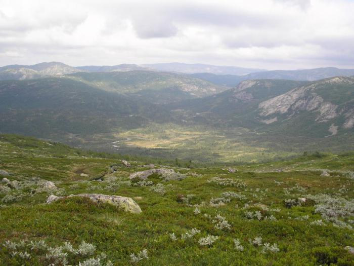
Relief refers to various irregularities or a set of forms of horizontal and vertical division of the earth's surface. Relief plays a huge role in the formation of landscapes. The nature of the flow, microclimate, distribution of soil and vegetation cover, and so on depend on the relief. In turn, the relief changes under the influence of these factors. Any form of relief, from a single hummock to a mountain range, does not remain unchanged. They are created and destroyed by the diverse and continuous processes operating on Earth.
Diverse landforms are classified in two directions: according to morphological and genetic characteristics.
According to morphological classification, the external features and dimensions of landforms are taken into account without assessing their origin and relationship.
This classification is used in topography and cartography because topographic maps primarily show the external outlines and dimensions of various landforms. Morphological classification is used when first becoming acquainted with landforms in elementary school.
Genetic classification of landforms is made based on taking into account their genesis (origin), age, relationship and dynamics. This classification makes it possible to consider landforms, generalizing them into genetic series. Related forms may not be similar in appearance, but they represent links in the same chain, although they are at different stages of their development. For example, a small ravine, a ravine and clouds are very different in appearance and size, but they are all different stages of the development of a form caused by the water-erosion process.
Neither the morphological nor the genetic principle of classification can be completely “independent”. Any form of relief is associated with a variety of processes. When they talk, for example, about karst or glacial landforms, they only emphasize the predominant role of some factor. Any form of relief is the result of the combined activity of many natural processes.
According to morphological characteristics, the most elementary is the division of the land surface into mountains and plains. Inside both of them there are micro-, meso- and macroforms, as well as positive (convex) and negative (hollow) forms.
The most important positive forms are a hill, a mountain, a ridge, a highland, a plateau, and a plateau.
The most important negative forms are hollows, gullies, ravines, various valleys and depressions, canyons and others.
A relief that completely depends on the geological structure - on the composition of rocks, the occurrence of their layers - is called structural. In recent years, humans have begun to play a huge role in the formation of relief. For example, open-pit coal mining leads to the formation of ravines; the creation of communication routes in the mountains leads to a change in the appearance of mountainous countries. All this contributes to the formation of anthropogenic relief.
The solid earth's surface has irregularities of various orders. The greatest (planetary) landforms are oceanic trenches and continents. They are the main elements of the relief of the earth's surface, arising in the process of formation and uneven development of the earth's crust, and correspond to the continental oceanic types of its structure. Planetary relief elements are divided into second-order relief forms - megaforms. These include mountain structures and large plains. Within mega relief forms, macro relief forms are distinguished. These are mountain ranges, mountain valleys, depressions of large lakes, etc. On the surface of macroforms there are mesoforms - medium-sized forms (hills, ravines) and microforms - small relief forms with height fluctuations of several meters or less (small dunes, gullies).
In order to depict the terrain on a plan or map, it is necessary to measure the height of various parts of our Earth. Absolute height is the elevation of a point on the earth's surface along a plumb line above sea level. In the Republic of Belarus, as in the Russian Federation, absolute altitude is measured from the level of the Baltic Sea, taken as 0 meters. In the city of Kronstadt, located on one of the islands in the Baltic Sea, there is a footstock - a rail with divisions. The absolute height is measured from the zero of this foot rod. This height can be positive or negative. If a point lies above sea level, then its height is considered positive (hills, heights, mountains), and if below it is considered negative (ocean depressions). Points on land (Caspian Lowland) can also have a negative absolute height. On plans and maps, absolute height is indicated by a point, around which the number of meters is marked. This designation is called a height mark. The difference in the absolute heights of points shows the relative height, that is, the elevation of one point on the earth's surface relative to another.
In different parts of the World Ocean, although they are all connected like communicating vessels, the levels are not the same. Thus, the ocean level near Kronstadt is 1.8 meters higher than the level of the Pacific Ocean near Vladivostok. There are several reasons for this; one of them is related to the processes occurring during the ebb and flow of the tides. For practical purposes, the average long-term level is used, which is taken as the initial level.
Main forms of mountainous landforms
Parts of the earth's surface that are highly elevated above the plains and strongly dissected are called mountains. They are delimited from the adjacent plains by a clear line of the base or have foothills - a transitional strip with lower altitudes than the mountains.
The mountains are very diverse. Most often, they form mountainous countries in which one can find peaks - individual mountains that rise noticeably above the general level of the mountainous country. For example, Elbrus in the Caucasus, Chomolungma in the Himalayas, Belukha in Altai. In the Sayan Mountains, Transbaikalia, and the Far East, mountains often have a conical shape with a flattened or rocky top. Such mountains are called hills. Special mountains formed as a result of long-term destruction are called small hills and are found, for example, in Central Kazakhstan. It is characterized by randomly scattered hills and small ridges of various shapes, sometimes with slightly pointed peaks and a wide base, with a relative height of 50 - 100 meters. They are separated by wide flat pits, often occupied by lakes, or valleys.
For the relief of mountainous countries, mountain ranges are typical - mountain structures stretched over long distances with a well-defined axis in the form of a single watershed line, along which the highest altitudes are grouped. The mountain range has two slopes, they are often asymmetrical, often of different steepness. For example, the Ural Mountains have a steep eastern slope and a gentle western slope, which is explained by the historical development of this mountainous country. The top part of the ridge is called a mountain ridge. Depending on the age of the mountainous country and its geological structure, it varies: the tops of young mountains are most often pointed, covered with glaciers, while those of old ones are rounded and plateau-like. Wide depressions with gentle slopes are called mountain passes. If a mountain range is not high and has soft, rounded peaks, then it is called a mountain ridge. Usually these are the remains of destroyed ancient mountains. For example, the Timan Ridge, the Yenisei Ridge and others.
A weakly dissected mountain uplift with a clearly defined base, approximately equally elongated in length and width, is called a mountain range. For example, the Putorana plateau in Eastern Siberia. The area where two or more mountain ranges intersect is called a mountain junction. Typically, the mountains in mountain junctions are high and inaccessible. An example is the Tabyn-Bogdo-Ola mountain junction in Altai. Mountain ranges of the same origin, located in a single order, make up mountain systems. The lower edges of such mountain systems are called foothills. Many African mountains have flat tops and steep or stepped slopes. Such mountains are called table mountains. They most often arise when flowing waters dissect stratified plains; the peaks of such mountains are formed by durable sediments. The permanent covering of mountain tops with snow is called squirrels (Altai), and the bare peaks located above the limits of vegetation are called char, which usually have a dome-shaped shape.
Mountains are divided into three groups according to their height:
1) Low mountains, or low mountains. Their absolute height is approximately 800–1000 meters. Such mountains usually have soft, rounded outlines and their altitudinal zonation is poorly defined. These are, for example, the Kazakh small hills, the Northern Urals, spurs of the Tien Shan, and individual ridges of Transcaucasia.
2) medium-high, mountains or mid-mountain. They have an absolute height of up to 2000 meters. These mountains also, as a rule, have gentle outlines and rounded peaks. They are often densely covered with forests, have gentle slopes, and are covered with loose sediments - products of weathering. Such mountains rise above the snow line, so their peaks are rarely covered with snow. It is extremely rare that these mountains have pointed peaks, narrow and jagged ridges (Urals, Khibiny, Novaya Zemlya mountains).
3) High mountains, or highlands. The absolute height of these mountains is more than 2000 meters above sea level. Such mountains often rise above the snow line, and therefore their peaks are often covered with snow and glaciers. They have steep slopes and are bare in the upper parts, that is, not covered with loose sediments and devoid of vegetation. Their peaks are rocky, with many sharp ridges and peaks (Pamir, Himalayas, Andes, Cordillera, Pyrenees, Alps, Caucasus Mountains, Tien Shan and others).
Based on their origin, mountains can be divided into tectonic and volcanic. Tectonic mountains arose as a result of the movement of the earth's crust. In mobile zones of the earth's crust, most often at the edges of lithospheric plates, rocks as a result of tectonic movements are crushed into folds of various sizes and steepness. This is how folded mountains are formed. On land, folded mountains are a rare phenomenon, since when they rise above sea level, the folds of rocks lose their plasticity and begin to break, producing cracks with fold displacements. Typical mountains of this type have been preserved only in isolated areas in the Himalayas, which arose during the era of Alpine folding.
With repeated tectonic movements, when folds of rocks that have lost their plasticity and hardened undergo fractures into large blocks of the earth's crust, which rise or fall, folded - block mountains arise. This type is typical for old mountains. Thus, the folded mountains of Altai, which arose during the Baikal and Caledonian eras of mountain building, were again subject to tectonic movements during the Hercynian and Mesozoic eras of folding. During the Alpine folding, they turned into folded - block mountains, like many other mountain structures.
Volcanic mountains are composed of products of volcanic eruptions; they have a characteristic conical shape. They are located, as a rule, near fault lines or the boundaries of lithospheric plates, where active volcanism occurs.
Volcanic mountains form unique shapes when destroyed by external agents. Here, as in other mountains, powerful accumulations of rocks and stones are formed, and “stone streams” descend along the rocks. The difference is that the “rock flows” descend not only along the outer slopes of the cone, but also along the inner slopes of the crater. Below the snow line, the main destroyer is rainfall. They cut through potholes and ravines radiating from the edges of the crater along the internal (crater) and external slopes. These potholes are called barrancos. At first, the barrancos are numerous and shallow, but then their depth increases. As a result of the growth of the outer and inner barrancos, the crater expands, the volcano gradually lowers and takes the shape of a saucer surrounded by a more or less raised rampart. After the eruption, the volcanic cone rises again and takes on sharper shapes.
Erosion mountains can arise as a result of the dissection of plateaus and flat hills by rivers. An example of such mountains is the many interfluve mountains of the Central Siberian Plateau (Vilyuisky, Tungussky, Ilimsky and others). They are characterized by table shapes and box-shaped and sometimes canyon-shaped valleys. Much more often, mountains of erosion origin are observed within the middle mountains. But these are no longer independent mountain systems, but parts of mountain ranges that arose as a result of the dissection of these ranges by mountain streams and rivers.
The main factors that affect mountains that rise above the snow line are frost weathering and the work of snow and ice. The presence of steep slopes helps weathering products quickly roll down and expose the surface of rocks for further weathering. Winds play a major role in the destruction of high mountains, the speed of which greatly increases with height. Therefore, the winds here are capable of blowing away not only small particles, but also larger debris.
The variety of rocks that make up the mountains leads to uneven weathering. As a result, areas composed of stronger rocks turn out to be highly elevated above areas composed of less durable rocks. With further weathering, highly elevated areas take the form of sharp peaks, peaks and rocks. Highland landforms were first studied in the Alps. Therefore, all high mountains with sharp peaks, peaks, sharp jagged ridges, snow, ravines and glaciers began to be called alpine-type mountains.
In mountains of medium altitude, frost weathering plays a very small role. True, chemical and organic weathering occurs more intensely here, but the areas of distribution of this weathering are relatively small, since the slopes of the mountains are sloping - the weathering products remain in place and delay further weathering. Here the main destroyers are flowing waters. Mountains are characterized by a large number of rivers and all kinds of watercourses. Even in desert countries, mountains are always rich in water, because the amount of precipitation usually increases with height. Mountain rivers are usually distinguished by a large slope of their channels, rapid flows, and an abundance of rapids, cascades and waterfalls, which determines their great destructive power. This leads to the fact that the mountain slopes are cut through by a large number of transverse valleys. The upper reaches of mountain streams, cutting into the slopes, reach watershed ridges and meet the upper reaches of rivers on the opposite slope. Their valleys little by little connect and cut the ridges into pieces. As the rivers continue to flow, the mountain ranges break up into separate mountains, which in turn fall apart. In the end, instead of mountain ranges, as a result of the work of flowing waters alone, hilly countries can appear. The lower the mountains become, the more sedimentary their slopes become, and the rivers flowing from the slopes reduce their destructive power. However, they continue their work, depositing destruction products at the bottom of valleys and washing away slopes. Ultimately, mountains can be destroyed to the ground, and in their place a leveled, slightly hilly surface remains. Only rare isolated mountains, which are called remnant mountains or witnesses, can remind of the mountainous country that was once here.
The process of destruction occurs so quickly that if the mountains had not risen, they would have been destroyed to the ground within one or two geological periods. But this does not happen, since the growth of mountains under the influence of the internal forces of the Earth continues for a long time. For example, if the Ural Mountains, which emerged as a high mountainous country at the end of the Paleozoic era, had not experienced further uplifts, they would have disappeared long ago. When mountains are destroyed, it is possible that the rise of the mountains occurs more slowly than their destruction. Under these conditions, the height of the mountains will decrease. When the uplift of mountains occurs faster than destruction, then the mountains rise.
Plains
The word “plain” or the expression “flat place” is well known to everyone. Everyone knows that there are no absolutely flat places, that plains can have a slope, hills, and so on. In geography, flat areas mean vast spaces in which the heights of neighboring areas differ little from each other. An example of one of the most perfect plains is the West Siberian Lowland and especially its southern part. In the northern part, the West Siberian Lowland is hilly; here there are rises reaching 200 meters in absolute height. But not all plains have a table-level surface. For example, within the East European (Russian) Plain there are elevations of up to 300 meters or more in absolute height and depressions, the absolute height of which is below ocean level (Caspian Lowland). The same can be said about other large lowlands (Amazonian, Mississippian, Laplata and others).
The flat regions include not only lowlands, but also many plateaus: Central Siberian, Arabian, Deccan, Laplat and others. Due to the high absolute height, their surface is quite dissected by flowing waters. So far we have talked about fairly large plains. But besides them there are many smaller plains, located mainly along the banks of rivers, lakes, and the sea. The plains are not the same in character, structure and origin. Therefore, they are divided into groups according to certain characteristics. If we take absolute height as a basis, then the plains are divided into lowlands (from 0 to 200 meters), hills (up to 300 - 500 meters) and plateaus (over 500 meters). Depending on the relief, plains are classified as flat, sloping, bowl-shaped, wavy and others. However, the shape, character and many other features of the plain are determined by its origin. Therefore, when considering the plains of the globe, they are divided into groups based on genetic principles.
Vast plains emerging from sea level are called primary plains. They are composed predominantly of horizontally lying layers, which determine the basic shape of the surface of these plains, which gives grounds to call the primary plains structural. The most typical example of a young primary plain is the Caspian Lowland, which became land only at the end of the Quaternary period. Its surface is almost not dissected by rivers. Examples of more ancient primary plains are the East European Plain and the Central Siberian Plateau. They were formed in Mesozoic and even Paleozoic times. These plains have been greatly modified by subsequent processes. For example, the surface of the Central Siberian Plateau is strongly dissected by rivers, the valleys of which are strongly incised to a depth of 250 - 300 meters. Individual sections of the plateau dissected by rivers, depending on their size, have different names. Vast areas with a more or less flat surface are called plateaus. Smaller areas, depending on the height, are called mesas or mesas. The flat top surface of mesas is usually due to the more resistant rock of the upper strata (quartzite, lava sheets, etc.).
In addition to the primary plains, there are plains of other origins. Typically these plains have a significantly smaller area. Plains formed by sediments and deposits of river waters are collectively called alluvial plains. Alluvial plains are divided into river and delta plains. Plains are formed by deposits of loose materials. Brought by melted glacial waters, they are called fluvioglacial. If plains arise on the site of former lakes, then they are called lacustrine. These plains are flat lake bottoms that have disappeared as a result of rivers draining them or filling lake basins with sediment. Lowland cavities often form along the coasts of the seas. In some cases, these plains are obtained as a result of the accumulation of sediments (accumulative plains), in others they are caused by the abrasive activity of the sea (abrasion plains).
The erupted mafic lavas can form large, flat spaces called lava plateaus. Lava plateaus are difficult to destroy. The river valleys here have a canyon-like character. Subsequently, the plains expand, and the plateau is divided into table mountains. On vertical slopes you can often see the columnar structure of basalts. As a result of long-term destruction of mountains, leveled, slightly hilly surfaces, known collectively as leveled surfaces or peneplains, can form. Unlike plains formed by accumulation, these plains are composed of hard rocks, the occurrence of which can be very diverse. Low areas among the mountains are places where destruction products accumulate. As a result, vast elevated plains are formed, which are called highland plateaus (Gobi, Tibet and others).
At first glance, it may seem that groundwater cannot greatly influence the earth's surface. However, groundwater produces significant geological work. They dissolve salts, carry away small particles, and in some cases create underground channels. Although the activity of groundwater proceeds slowly, its results significantly affect the nature of the earth's surface.
Landslides and landslide relief.
Sometimes landslide phenomena manifest themselves very clearly. For example, in 1839, the village of Fedorovka, located not far from Saratov, completely slipped towards the Volga. In 1884, in Saratov, part of the bank slid down to the river, and buildings located along the slope collapsed. Similar cases are often observed in other places, mainly along river banks. They are called landslides. The examples given refer to cases where sliding sections of the banks led to the destruction of buildings. In fact, landslides of banks and slopes are observed much more often. Traces of landslides can be observed on almost every river with high banks, especially if the banks are composed of clay. Landslide banks are uneven, stepped and, as it were, pitted with depressions of various sizes and shapes. In the depressions you can see springs, swamps and small lakes.
Landslides are most often caused by groundwater. If the rock layers that make up high banks or slopes have a certain slope, then groundwater will flow towards the slope. When there is a large amount of groundwater (in rainy years) and in the presence of impermeable layers composed of clays, the overlying layers can break off and slide down the smooth, abundantly wetted clay surface. Precipitation also accelerates this process by saturating the soil with water and increasing its weight and mobility. When there is heavy rain, landslides can also occur in horizontally lying clayey rocks. Clay masses saturated with water slide easily due to their increased weight. A landslide usually has the shape of a semicircle, the open side of which faces the valley. The edges of the landslide protrude, and the bottom of the landslide usually declines toward the slopes. The bottom microrelief is usually very complex. The width of the semicircle (from cape to cape) can be very different - from several meters to a few kilometers. If landslide processes are very developed, then neighboring circuses merge, and a so-called landslide terrace is formed, which is characterized by the unevenness of its surface. Landslide phenomena make the construction of various structures very difficult.
Collapse forms.
In thick layers of loose sediments (especially loess), with insignificant moisture, local soil subsidence can form. Melted snow waters here collect in depressions and slowly seep through the ground. At the same time, water dissolves salts and carries away small particles of water. As a result of this process, significant depressions are formed on the surface. The most common of them are pods or sedate “saucers”, which have a rounded shape with very gentle slopes. Their depth usually does not exceed 5–7 meters, and their width is 50–100 meters. Occasionally, steppe saucers up to several kilometers wide are found. Pods are widespread in Western Siberia, on the loess plains of Ukraine, in the Perekop steppe and other areas. If a river cuts through loess strata, then the underground waters that feed it work especially vigorously. As a result, chains of sinkholes appear on the surface along underground streams, and sometimes even failures can form. These forms are widespread in Central Asian regions.
Karst and karst landforms.
Limestones, gypsum and other related rocks almost always have a large number of cracks. Rain and snow waters go deep into the earth through these cracks. At the same time, they gradually dissolve limestones and widen the cracks. As a result, the entire thickness of limestone rocks is penetrated by a large number of different passages.
Here, funnel-shaped depressions, natural wells and shafts, elongated but closed depressions of various sizes and shapes are striking. Such areas are called karst areas or simply karst. Karst areas are characterized by the absence of surface water, which causes poor vegetation development. In karst areas, underground rivers, powerful springs, small but deep lakes with clean water, and so on are widespread.
The main forms of relief characteristic of karst areas are: karsts, sinkholes, karst wells and mines, elongated closed basins (blind valleys) and caves.
Small streams of atmospheric water, flowing along the inclined surface of limestone, wash away weathering products and simultaneously dissolve the rock. As a result, narrow grooves are formed on the surface of the limestone, the depth of which varies from several centimeters to one to two meters. Areas covered with these grooves are called karrs, and large areas of karrs are called kar fields. Subsequently, the carr furrows deepen, the ridges separating the furrows break up into separate blocks. A similar “ruin” surface of limestone is characteristic of most karst areas of the globe.
Relief of the ocean floor
The main way to study the topography of the bottom of seas and oceans is to measure depths. The depths of shallow water basins are known to be measured using a simple lot. However, great depths of seas and oceans cannot be measured with such a lot, since the weight of the cable will be significantly greater than the weight of the cargo. The simplest instrument for measuring sea depths is Brook's lot. It consists of an iron tube onto which a weight is placed. As soon as the tube touches the bottom, the weight is automatically released and the tube floats, or is brought to the surface. Currently, the steel string on which the lot is attached is lowered using a special device called a depth gauge. The depth gauge will allow you to mechanically measure the length of the cable. The moment the lot touches the bottom, the meter automatically turns off and shows the depth. The lot tube captures the soil sample. At the same time, a thermometer placed in the tube records the bottom temperature of the water. The main disadvantage of measuring depth using lots is the length of the operation. For example, it takes about one hour to lower a lot to a depth of four kilometers, and about two hours to lower it to a depth of six kilometers. The lifting of the lot is done even more slowly, and each measurement requires the vessel to stand for a long time.
Therefore, the method of measuring depths using an echo sounder is used. As you know, sound travels in water at a speed of about 1500 meters per second. If a strong sound is made on the surface of the water, then the sound wave, having reached the bottom, will be reflected and at the same speed will go to the surface of the water. By noting exactly the moment of sound occurrence and the moment of return of the reflected wave, it is easy to calculate the depth of a given place. This method of measuring depths requires very little time and measurements can be carried out without stopping the vessel. Currently, ultrasonic waves with a frequency of about 200,000 vibrations per second are used to measure depth. Ultrasonic waves are sent and captured by special instruments that automatically draw a detailed profile of the bottom along the ship's path. The echogram also makes it possible to get an idea of the nature of the soil at the bottom of the sea. If the bottom is composed of silty soil, the lines of the echogram are wide, if the soil is hard, they are narrow.
Depths determined using soundings are plotted on a map and isobaths are drawn. For oceans and seas, only the most necessary isobaths are drawn. Usually, for a rough image of the main forms of relief of the ocean floor, isobaths of 200 meters are taken, limiting the continental shelf, 2000 meters, limiting the continental foundations, 6000 meters, marking the location of the main depressions. For greater clarity, different degrees of depth are painted with shades of blue paint from light to dark. To obtain a more detailed map of the seabed relief, it is necessary to use a large number of steps.
To get an accurate idea of the topography of the bottom of oceans and seas, a very large number of measurements are needed. Until recently, the number of measurements was small. The recent rapid increase in the number of measurements has significantly expanded and clarified our understanding of the topography of the bottom of the World Ocean, but the previously identified large morphological elements have remained the same. An isobath of 200 meters, as before, now clearly outlines the continental shelf in the coastal parts of the oceans. Depths from 200 to 2000 - 2500 meters reveal the area of the continental slope. Deeper (2500 - 5000 meters) is the most extensive area of the World Ocean, which is called the pelagic, or the area of the bed of the World Ocean. Oceanic depressions have even greater depths (up to 10,000 or more).
Previously, the continental shelf was considered as a plain with a slight slope. New measurements show that this part of the ocean has a more complex topography. In areas of Quaternary glaciation, the surface of continental shallows has numerous basins, troughs and banks (hill-like rises of the bottom). The bottom in these parts is covered with poorly sorted glacial sediments. Near the mouths of large rivers, the continental shallows are mostly flat and composed of silts of river origin. The continental shelf adjacent to the mountainous areas is narrow and has a very complex topography. Thus, the continental shelf is like a transition from land to sea, which in recent geological periods have repeatedly replaced each other. The average depth of the continental shallows is 64 meters, and the average depth of its edge is 132 meters. However, within the shallows there can be pits and trenches 300 - 400 and even 500 meters deep. The width of continental shoals ranges from several kilometers to 400 – 500 kilometers. On average it is 70 kilometers.
The average height of the continental slope is 3660 meters, but can be much higher. For example, off the western coast of South America it reaches 5000 - 7000 meters, and off the Philippine Islands even 9000 meters. The angle of inclination of the continental slope is on average 4-5°, but sometimes reaches up to 40°. The surface of the continental slopes is straight inclined or smoothly curved, but hills and ridges are often found on the slopes. Particularly typical of continental slopes are underwater canyons that resemble river valleys or troughs. There are especially many of them on the east coast of the United States, off the coasts of Africa, South America and the marginal seas of East Asia. Submarine canyons differ from river valleys by a very large angle of incidence along the longitudinal profile.
The pelagic region is generally flat in nature, but a number of large depressions stand out among it.
The bottom topography of the Atlantic Ocean is the most studied. In its northern part, from the shores of Greenland to the northern part of the British Isles, there is an underwater elevation with depths from 320 to 600 meters, known as the Thompson Threshold. It separates the deep areas of the Arctic and Atlantic oceans, preventing the penetration of cold bottom waters of the polar basin into the Atlantic Ocean. Characteristic of the Atlantic Ocean is a median rise of the bottom with a depth of 2000-3000 meters, which stretches from the Arctic Circle to 58° south latitude. It stretches the entire length of the ocean and generally follows its shape. To the east and west of the median rise are the most depressed parts of the Atlantic Ocean floor: the European-African with depths of 4000-6000 meters and the American - 5000-7000 meters. The deepest place in the Atlantic Ocean is the depression north of the island of Puerto Rico (8525 meters).
The Pacific Ocean has the greatest average depth (about 4,300 meters) and the greatest absolute depths (up to 11,022 meters). An isobath of 5,000 meters limits most of the ocean; these depths occupy more than 50% of its total area. The greatest depths are located along the outskirts of the Pacific Ocean, mainly in its western half. The most important of them are: the Aleutian depression (south of the Aleutian Islands) with depths of more than 6,000-7,000 meters; Kurilskaya (east of the Kuril Islands) over 7,000-8,000 meters with the greatest depth of 8,560 meters; The Philippine Trench is over 8,000-9,000 meters and its greatest depth is about 11,022 meters; Tonga depression about 9,000 meters and others. In the eastern part of the ocean, the deepest depression is the Peruvian (over 7,000 meters). Most depressions in the Pacific Ocean look like highly elongated troughs, the direction of which is approximately parallel to the direction of the mountain ranges of nearby islands.
The Indian Ocean also has a significant median depth (3,900 meters), with about 50% of its area having a depth of 4,500-5,000 meters. In the Indian Ocean, two uplifts of the bottom are known, one of which is, as it were, a continuation of Hindustan, and the second a continuation of Antarctica. The deepest elongated depressions are located in the eastern part of the ocean. The deepest of them is located near the Sunda Islands (6,000 - 7,000 meters).
The Arctic Ocean has been studied in detail in recent years. It has now been revealed that in the middle part of the ocean (from the New Siberian Islands to Greenland) there is a large underwater ridge (named after Lomonosov), on both sides of which there are deep areas surrounded by wide continental shoals of Eurasia and North America. The greatest depth of the ocean is 5,440 meters.
There are also mountain ranges in the ocean. Thus, in 1984, Soviet expeditions discovered a 1,800-kilometer-long water ridge in the Arctic Ocean. It was named after the great Russian scientist M.V. Lomonosov. The most important discovery of recent years is the mid-ocean ridges. These are swell-like uplifts of the earth's crust. They are usually located almost in the middle of each ocean, forming a single chain. A fault usually runs along the axis of the uplift - a gorge up to three kilometers deep and up to 50 kilometers wide.
Mountains are not only characteristic of land. Single mountains are scattered throughout the ocean floor. There are many volcanoes here, both active and extinct. Some of them rise above the water surface, forming islands, others spew lava and ash underwater, which settle to the bottom. Inactive ocean volcanoes differ from land volcanoes in that their tops are flat, leveled by waves and currents.
For a correct understanding of the development of the oceans, the study of seabed soils is of great importance. To take soil samples from the ocean floor, you can use a lot, at the lower end of which a tube with lard is placed, to which the soil sticks. To obtain a large amount of soil, a long thin tube is used, which, when it hits the bottom, penetrates into the thickness of the sediment and captures a column of soil up to 0.5 meters high. More advanced tubes make it possible to obtain columns of 1.5 - 2 meters, and tubes with a suction piston even up to 15 - 20 meters. To obtain large quantities of soil, snorers are used, which have two doors in the form of open cups, closing with their holes, the cups capture the soil. If it is necessary to obtain large soil samples, dredges are used, that is, large canvas bags sewn with holes to a heavy metal frame. The frame drags along the bottom, crashes into the ground and captures it in bags.
Studies have shown that in the area of the continental shallows, the ocean floor is covered with debris brought from the mainland. Along the coast it is sand, and further on it is clay and or from rocks of continental origin. The total area of distribution of these continental silts is about 90 million square meters.
Sediments of continental origin usually do not reach the pelagic region and therefore silts of organic origin predominate here, that is, the remains of skeletons and shells of microscopic plants and animals. The most widespread are silts formed by calcareous shells and skeletons of single-celled animals Globigerina and Pteropods. Globigerina silt is most common at depths from 700 to 5,000 meters. Its distribution area is about 140 million square meters. Pteropod mud is much less common. Its distribution area is about 1.3 million square meters, depth is 700 - 2,800 meters. In warm seas and oceans, radiolarian silt, consisting of radiolarian skeletons, is widely developed. The total area of its distribution is about 10.4 million square meters. In the cold Arctic seas, the most widespread is diatomaceous ooze, consisting of the skeletons of diatoms. Its distribution area is about 26.5 million square meters.
In the deepest areas, the bottom is covered almost exclusively with red deep-sea clay, which is apparently products of the decomposition of volcanic dust and colloidal clay, carried by air and sea currents. Deposition of deep-sea red clay occurs extremely slowly. This can be seen from the fact that in the upper parts of the soil columns the teeth of sharks that lived in the Tertiary period were discovered. The area of distribution of deep-sea clay clay is over 100 million km 2. It is typical for depths exceeding 4,000 - 5,000 meters. The almost complete absence of organic remains in deep-sea sediments is explained by the fact that the smallest shells and skeletons of single-celled animals, slowly sinking, manage to dissolve before reaching great depths.
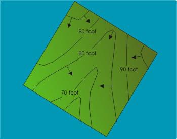
Despite the wide variety of unevenness of the earth's surface, the main forms of relief can be distinguished: mountain, basin, ridge, hollow, saddle.
The top of the mountain, the bottom of the basin, and the saddle point are characteristic points of the relief; the watershed line of a ridge, the drainage line of a ravine, the line of the base of a mountain or ridge, the edge line of a basin or ravine are characteristic lines of the relief.
Classification
Landforms vary:
Planetary landforms
- Geosynclinal belts
- Mid-ocean ridges
Mega landforms
Macro relief forms
Individual ridges and depressions of a mountainous country Examples: Main Caucasus Range, Bzyb Range (Abkhazia)...
Mesoforms of relief
Microforms of relief
Nanoforms of relief
Examples: meadow tussock, surchin, small erosion grooves, ripple marks on the surface of aeolian forms or on the seabed.
Methods of depicting relief
The method of depicting the relief should provide a good spatial understanding of the terrain, reliable determination of the directions and steepness of slopes and marks of individual points, and the solution of various engineering problems.
Since the existence of geodesy, several methods have been developed for depicting relief on topographic maps. Let's list some of them:
- A promising way.
- Washing method. This method is used on small-scale maps. The Earth's surface is shown in brown: the larger the marks, the thicker the color. The depths of the sea are shown in blue or green: the greater the depth, the deeper the color.
- Hatching method.
- Marking method. With this method, marks of individual terrain points are marked on the map.
- Contour method.
Currently, on topographic maps, the method of contours is used in combination with the method of marks, and on one square decimeter of the map, as a rule, at least five point marks are labeled.
Notes
Wikimedia Foundation. 2010.
See what “Relief form” is in other dictionaries:
landform- Unevenness of the earth's surface of different sizes and positions... Dictionary of Geography
They are formed under the influence of waves and currents. A distinction is made between adjacent forms, i.e. those connected to the main shore over a long distance with their inner side (terraces, beaches, coastal ramparts, ditches); free connected to land by one... ... Geological encyclopedia
This term has other meanings, see Beach (meanings). 90 mile beach Australia Beach (from the French plage ... Wikipedia
This term has other meanings, see Kar (meanings). Kar, occupied by a glacier ... Wikipedia
Hel Spit (left), Baltic Spit (center) and Curonian Spit (right) on the Baltic Sea coast. This term has other meanings, see Spit. Spit is a low alluvial strip of land on the shore of a sea or lake, with ... Wikipedia
A spit is a low alluvial strip of land on the shore of a sea or lake, connected at one end to the shore. Contents 1 By sea 1.1 Sea of Azov 1.2 ... Wikipedia
Y; and. [lat. fōrma appearance, appearance, appearance] 1. External outline, external appearance of an object. The earth has the shape of a ball. Square f. A curved object. Clouds change their shapes. Vessels of various shapes. Water poured into a vessel takes the shape of the vessel.... ... encyclopedic Dictionary
form- s; and. (lat. fōrma appearance, appearance, appearance) see also. for the form, throughout the form, in the form, mold, formal, uniform... Dictionary of many expressions
Elementary sections of the earth's surface of varying degrees of curvature and steepness. From combinations of G. r. consists of any form of relief. Based on the angle of inclination, horizontal rivers are distinguished: horizontal and subhorizontal (plateau-like peaks of positive forms... Great Soviet Encyclopedia
Classifications of landforms
There are several classifications of landforms of the Earth, having different bases. According to one of them, two groups of relief forms are distinguished:
- positive - convex in relation to the horizon plane (continents, mountains, hills, hills, etc.);
- negative - concave (oceans, basins, river valleys, ravines, gullies, etc.).
The classification of landforms of the Earth by size is presented in Table. 1 and in Fig. 1.
Table 1. Landforms of the Earth by size

Rice. 1. Classification of the largest landforms
Let us separately consider the relief forms characteristic of the land and the bottom of the World Ocean.
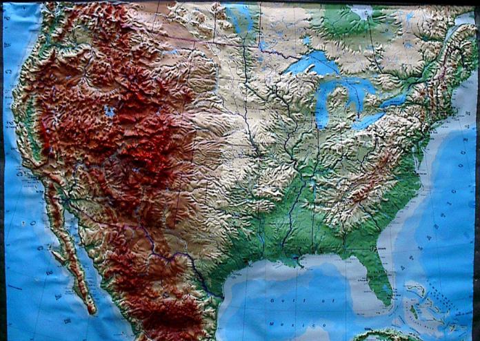
Relief of the Earth on the World Map

Landforms of the ocean floor
The bottom of the World Ocean is divided by depth into the following components: continental shallows (shelf), continental (coastal) slope, bed, deep-sea (abyssal) basins (trenches) (Fig. 2).
Mainland Shoal- the coastal part of the seas and lying between the coast and the continental slope. This former coastal plain is expressed in the topography of the ocean floor as a shallow, slightly hilly plain. Its formation is mainly associated with the subsidence of individual land areas. This is confirmed by the presence within the continental shallows of underwater valleys, coastal terraces, fossil ice, permafrost, remains of terrestrial organisms, etc. Continental shallows are usually distinguished by a slight bottom slope, which is practically horizontal. On average, they decrease from 0 to 200 m, but within their limits there can be depths of over 500 m. The relief of the continental shallows is closely related to the relief of the adjacent land. On mountainous coasts, as a rule, the continental shelf is narrow, and on flat coasts it is wide. The continental shelf reaches its greatest width off the coast of North America - 1400 km, in the Barents and South China Seas - 1200-1300 km. Typically, the shelf is covered with clastic rocks brought by rivers from land or formed during the destruction of coastlines.

Rice. 2. Relief forms of the ocean floor
Continental slope - the inclined surface of the bottom of the seas and oceans, connecting the outer edge of the continental shallows with the ocean bed, extending to a depth of 2-3 thousand m. It has fairly large angles of inclination (on average 4-7°). The average width of the continental slope is 65 km. Off the coast of coral and volcanic islands, these angles reach 20-40°, and on the coral islands there are even larger angles, almost vertical slopes - cliffs. Steep continental slopes lead to the fact that in areas of maximum bottom inclination, masses of loose sediments slide to the depths under the influence of gravity. In these areas, a bare slope or muddy bottom may be found.
The relief of the continental slope is complex. Often the bottom of the continental slope is cut by narrow deep gorges-canyons. They are often found near steep rocky shores. But there are no canyons on continental slopes with a gentle bottom slope, as well as where there are stumps of islands or underwater reefs on the outer side of the continental shallows. The tops of many canyons are adjacent to the mouths of existing or ancient rivers. Therefore, canyons are considered as an underwater continuation of flooded river beds.
Another characteristic element of the relief of the continental slope is underwater terraces. These are the underwater terraces of the Sea of Japan, located at depths from 700 to 1200 m.
ocean bed- the main space of the bottom of the World Ocean with prevailing depths of more than 3000 m, extending from the underwater edge of the continent into the depths of the ocean. The area of the ocean floor is about 255 million km 2, i.e., more than 50% of the bottom of the World Ocean. The stock has slight angles of inclination, on average they are 20-40°.
The relief of the ocean floor is no less complex than the relief of the land. The most important elements of its relief are abyssal plains, oceanic basins, deep-sea ridges, mid-ocean ridges, hills and submarine plateaus.
In the central parts of the oceans are located mid-ocean ridges, rising to a height of 1-2 km and forming a continuous ring of uplifts in the Southern Hemisphere at 40-60° S. w. Three ridges extending northward from it extend meridianally in each ocean: the Mid-Atlantic, Mid-Indian and East Pacific. The total length of the mid-ocean ridges is more than 60 thousand km.
Between the mid-ocean ridges there are deep-sea (abyssal) plains.
Abyssal plains- flat surfaces of the bottom of the World Ocean, which lie at depths of 2.5-5.5 km. It is the abyssal plains that occupy approximately 40% of the ocean floor area. Some of them are flat, others are undulating with a height range of up to 1000 m. One plain is separated from the other by ridges.
Some of the single mountains located on the abyssal plains protrude above the surface of the water in the form of islands. Most of these mountains are extinct or active volcanoes.
Chains of volcanic islands above a subduction zone, occurring where one oceanic plate subducts beneath another, are called island arcs.
In shallow waters in tropical seas (mainly in the Pacific and Indian oceans), coral reefs form - calcareous geological structures formed by colonial coral polyps and certain types of algae that can extract lime from sea water.
About 2% of the ocean floor is occupied deep-sea (over 6000m) depressions - trenches. They are located where oceanic crust subducts beneath continents. These are the deepest parts of the oceans. Over 22 deep-sea depressions are known, of which 17 are located in the Pacific Ocean.
Landforms
The main landforms on land are mountains and plains.
Mountains - isolated peaks, massifs, ridges (usually more than 500 m above sea level) of various origins.
In total, 24% of the earth's surface is mountainous.
The highest point of the mountain is called mountain peak. The highest mountain peak on Earth is Mount Chomolungma - 8848 m.
Depending on the height, mountains are low, medium, high and highest (Fig. 3).

Rice. 3. Classification of mountains by height
The highest mountains of our planet are the Himalayas, examples of high mountains are the Cordillera, Andes, Caucasus, Pamir, middle ones are the Scandinavian Mountains and the Carpathians, low ones are the Ural Mountains.
In addition to the mountains mentioned, there are many others on the globe. You can get acquainted with them from the atlas maps.
According to the method of formation, the following types of mountains are distinguished:
- folded - formed as a result of the folding of a thick layer of sedimentary rocks (mainly formed during the Alpine era of mountain building, which is why they are called young mountains) (Fig. 4);
- blocky - formed as a result of the rise of hard blocks of the earth's crust to a great height; characteristic of ancient platforms: the internal forces of the Earth split the rigid foundation of the platforms into separate blocks and raise them to a considerable height; as a rule, ancient or revived) (Fig. 5);
- folded-block mountains are old folded mountains that were largely destroyed, and then, in new periods of mountain building, individual blocks of them were again raised to great heights (Fig. 6).

Rice. 4. Formation of folded mountains

Rice. 5. Formation of old (block) mountains
Based on their location, epigeosynclinal and epiplatform mountains are distinguished.
Based on their origin, mountains are divided into tectonic, erosional, and volcanic.

Rice. 6. Formation of folded-block renewed mountains
Tectonic mountains- these are mountains that were formed as a result of complex tectonic disturbances of the earth’s crust (folds, thrusts and various types of faults).
Erosion mountains - highly elevated plateau-like regions of the earth's surface with a horizontal geological structure, strongly and deeply dissected by erosion valleys.
Volcanic mountains - These are volcanic cones, lava flows and tuff sheets, distributed over a large area and usually superimposed on a tectonic base (on a young mountainous country or on ancient platform structures, such as the volcanoes of Africa). Volcanic cones are formed by accumulations of lava and rock fragments erupted through long cylindrical vents. These are the Maoin mountains in the Philippines, Mount Fuji in Japan, Popocatepetl in Mexico, Misti in Peru, Shasta in California, etc. Heat cones They have a structure similar to volcanic cones, but are not so high and are composed mainly of volcanic scoria - porous volcanic rock that looks like ash.
Depending on the areas occupied by mountains, their structure and age, mountain belts, mountain systems, mountainous countries, mountain ranges, mountain ranges and uplifts of a smaller rank are distinguished.
mountain range called a linearly elongated positive form of relief, formed by large folds and having a significant extent, mostly in the form of a single watershed line, along which the most
significant heights, with clearly defined ridges and slopes facing in opposite directions.
Mountain chain- a long mountain range, elongated in the direction of the general strike of the folds and separated from adjacent parallel chains by longitudinal valleys.
Mountain system- a collection of mountain ranges, chains, formed during one geotectonic epoch and having spatial unity and a similar structure, uplands(extensive mountain uplifts, which are a combination of high plains, mountain ranges and massifs, sometimes alternating with wide intermountain basins) and intermountain depressions.
Mountain country- a set of mountain systems formed in one geotectonic era, but having different structure and appearance.
Mountain belt- the largest unit in the classification of mountainous relief, corresponding to the largest mountain structures, united spatially and according to the history of development. Usually the mountain belt extends for many thousands of kilometers. An example is the Alpine-Himalayan mountain belt.
Plain- one of the most important elements of the relief of the land surface, the bottom of the seas and oceans, characterized by small fluctuations in heights and slight slopes.
The formation diagram of the plains is shown in Fig. 7.

Rice. 7. Formation of plains
Depending on the height among the plains, the land is divided into:
- lowlands - having an absolute height from 0 to 200 m;
- elevations - no higher than 500 m;
- plateaus.
Plateau- a vast area of relief with a height of 500 to 1000 m or more with a predominance of flat or slightly undulating watershed surfaces, sometimes separated by narrow, deeply incised valleys.
The surface of the plains can be horizontal or inclined. Depending on the nature of the mesorelief complicating the surface of the plain, flat, stepped, terraced, wavy, ridged, hilly, hilly and other plains are distinguished.
Based on the principle of the predominance of existing exogenous processes, the plains are divided into denudation, formed as a result of the destruction and demolition of pre-existing terrain irregularities, and accumulative, resulting from the accumulation of thick layers of loose sediments.
Denudation plains, the surface of which is close to the structural surfaces of a slightly disturbed cover, are called reservoir.
Accumulative plains are usually divided into volcanic, marine, alluvial, lacustrine, glacial, etc. Accumulative plains of complex origin are also common: lacustrine-alluvial, deltaic-sea, alluvial-proluvial.
The general features of the relief of planet Earth are the following:
Land occupies only 29% of the Earth's surface, which is 149 million km 2. The bulk of the landmass is concentrated in the Northern Hemisphere.
The average height of the Earth's land is 970 m.
On land, plains and low mountains up to 1000 m high predominate. Mountain elevations above 4000 m occupy an insignificant area.
The average depth of the ocean is 3704 m. The topography of the bottom of the World Ocean is dominated by plains. Deep-sea trenches and trenches account for only about 1.5% of the ocean's area.
Terrain and its depiction on maps
The terrain very rarely consists of flat areas of the earth's surface; more often it consists of many convex or concave irregularities, varying in shape and size. These irregularities are usually called the terrain.
Landforms can be positive or convex (mountains, mountain ranges, hills, etc.) and negative or concave (depressions, basins, river valleys, etc.).
Each form of relief is formed by surfaces - slopes (slopes) of varying length, steepness, height and orientation. Intersecting each other at different angles and in different directions, the slopes form various elementary forms of relief, which can be reduced to the following five typical forms:
A mountain is a section of the earth’s surface that is significantly elevated above the surrounding area (500 m or more above sea level). The highest part of the mountain is usually called the mountain summit. It should be peak-shaped, plateau-shaped or other shape. The top point of a mountain peak is usually called the summit, the lower part of the mountain (base) is called the base, and the slope from the top to the base is called the slope.
A hill usually round or oval in shape with gentle slopes and sometimes a weakly defined foot, with a relative height of up to 200 m, is usually called a hill or height. Artificially created hills are called mounds.
A hill (mountain, height) dominating the surrounding area is usually called command height.
The vertical distance from any point on the Earth's surface to the average level of the sea surface (level surface) is usually called absolute height.
A vast area of the earth's surface, which is a combination of plateaus, mountain ranges and massifs, sometimes alternating with wide flat basins, is usually called a highland. An elevated plain with a flat or undulating, weakly dissected surface, limited by distinct ledges from neighboring plain spaces, is usually called a plateau. Typically, plateaus are poorly dissected, their central part is a flat, undulating or hilly plain, and the edges have individual peaks or groups of peaks. Sometimes there are plateaus, the surface of which is cut by deep crevices in the central parts. Such highly dissected and highly elevated plateaus are called plateaus.
A mountain range is a large, linearly elongated positive landform with clearly defined slopes intersecting at the top.
The line dividing the flow of atmospheric water along two slopes directed in different directions is usually called a watershed.
The sharply defined summit part of a mountain range is usually called a ridge. It usually has a sharp jagged shape and is divided into separate peaks by saddle saddles. In a longitudinal section, the crest of a mountain range is a wavy line, its protruding parts correspond to the peaks. The mountain range in its plan outline has a sinuous shape with mountain spurs extending to the sides and their smaller branches.
An elongated hill with gentle slopes, gradually turning into a plain, and a not sharply defined base is usually called a ridge. A small elongated hill with a well-defined base is usually called a ridge. A basin is a depression, usually cup-shaped. It must be closed on all sides or open in one or two directions. Its lower part is usually called the bottom. Sometimes the bottom of the basin is swampy or occupied by a lake. A small basin with little depth and a flat bottom is called a saucer or depression. A very small basin is usually called a pit. A hollow is an elongated depression, descending in one direction and having gentle, usually turfed slopes. The slope of a hollow with a clearly defined upper bend is usually called the edge, and the line along the bottom towards which the slopes are directed and which connects the lowest points, the deepest parts of the bottom, is called the thalweg. Dells are often overgrown with bushes or forests. Their bottom is sometimes swampy.
Dells that are large in size, usually have gentle slopes and a weak bottom slope, are called valleys. Rivers flow along the bottom of most of the valleys.
Deep steep erosions formed by temporary watercourses are called ravines. Οʜᴎ occur on elevated plains, slopes of hills or valleys composed of loose, easily eroded rocks. Their length can reach 5–10 km, width up to 50 m, and depth 30 m or more. The steepness of the slopes of ravines depends on the composition of the soil and often reaches 45–50° or more. Under the constant influence of melt and rain water, they quickly increase. Over time, after reaching the waterproof layer, the ravine stops growing in depth, its slopes become flatter, overgrown with grass and it turns into a beam. Balka - a dry valley or with a temporary watercourse. Its bottom is gently concave, its slopes are convex. The length of the beam is from hundreds of meters to 20 - 30 km, the width at the top is usually 100 - 250 m, at the bottom 15 - 30 m, the depth ranges from 20 to 50 m. The steepness of the slopes of the beams reaches 10 - 25°. The slopes and bottom are usually turfed and often covered with woody vegetation.
A large gully with a wide flat bottom and gentle slopes, a type of dry valley that is filled occasionally in the spring or during a flood with water, is usually called a dry valley.
Small washouts (the first stage of gully development) with steep exposed walls and a narrow, sometimes winding bottom are called gullies.
Horizontal or slightly inclined areas of various origins on the slopes of mountains, river valleys and on the coasts of lakes and seas, limited by ledges, are called terraces. Οʜᴎ can be single or arranged in the form of steps one above the other. The most common are river terraces, developed on the slopes of most river valleys and being remnants of the former bottom.
Deep river valleys with very steep, often steep slopes and a narrow bottom, usually completely occupied by the river bed, are called canyons: Their depth can reach several tens and sometimes hundreds of meters. Narrow and deep mountain valleys with steep, sometimes sheer, rocky slopes and a narrow winding bottom are called gorges. Unlike the canyon, the bottom of the gorge is somewhat wider and is not completely occupied by the river bed.
Deep and narrow valleys in the mountains, with steep or overhanging slopes in places, made entirely of bedrock, are called gorges. Their width is insignificant, and the bottom is completely occupied by the river bed, which usually has a high flow speed.
A saddle is a depression between the peaks of a mountain range. It is almost always the starting point of two valleys, diverging in opposite directions.
The lowest and most accessible place in the crest of a mountain, ridge or massif is usually called a pass. As a rule, the pass is located in saddles, less often on inclined parts of ridges. The height of the passes depends on the height of the mountain ranges.
Deeply incised and low-lying saddles on both slopes of one ridge or between two mountain ranges are called mountain passes.
Landforms - concept and types. Classification and features of the category "Relief Forms" 2017, 2018.
Accumulative wind activity Accumulative wind activity consists in the accumulation of aeolian deposits, among which two genetic types are distinguished - aeolian sands and aeolian loess (table). In modern times, these deposits are formed in deserts and on their... .
The work of ice in transporting debris. Loose debris transported or deposited by ice is called a moraine. The composition of the moraine includes fragments of various sizes: from large blocks (glacial boulders) with scars, grinding to crushed stone, gruss, sand,....
Ticket 23 Canada. Population and economy. CANADA, a state in North America. It occupies the northern part of the mainland and the adjacent islands, including the Canadian Arctic Archipelago, the islands of Newfoundland, and Vancouver. Borders with the USA, there is... .
Relief This is a set of irregularities on the earth's surface. Relief in drawings can be represented by color, marks, strokes and contours. In geodesy, the method of contours is used. A horizontal line is a closed curved line connecting points with the same... .
When studying geography and topography, we come across such a concept as terrain. What is this term and what is it used for? In this article we will understand the meaning of this word, find out what types there are and much more.
Concept of relief
So what does this term mean? Relief is a set of irregularities on the surface of our planet, which are made up of elementary forms. There is even a separate science that studies its origin, history of development, dynamics and internal structure. It's called geomorphology. The relief consists of individual forms, that is, natural bodies that represent its individual parts and have their own dimensions.
Variety of shapes
According to the morphological principle of classification, these can be both positive and negative. The first of them rise above the horizon, representing a rise in the surface. Examples include a hillock, a hill, a plateau, a mountain, etc. The latter, accordingly, form a depression relative to the horizon line. These can be valleys, beams, depressions, ravines, etc. As mentioned above, the shape of the relief is composed of individual elements: surfaces (edges), points, lines (edges), corners. According to the degree of complexity, complex and simple natural bodies are distinguished. Simple forms include mounds, hollows, hollows, etc. They are individual morphological elements, the combination of which forms a form. An example is a mound. It is divided into the following parts: bottom, slope, top. A complex form consists of a number of simple ones. For example, a valley. It includes the riverbed, floodplain, slopes, etc.
Based on the degree of slope, subhorizontal surfaces (less than 20 degrees), inclined surfaces and slopes (more than 20 degrees) are distinguished. They can have different shapes - straight, convex, concave or stepped. According to the degree of extension, they are usually divided into closed and open.
Types of reliefs
The combination of elementary forms that have a similar origin and extend over a certain space determines the type of relief. In large areas of our planet, it is possible to unite several individual species on the basis of similar origin or differences. In such cases, it is customary to talk about groups of relief types. When the association is made on the basis of their formation, they speak of genetic types of elementary forms. The most common types of land relief are flat and mountainous. Based on height, the former are usually divided into depressions, hills, lowlands, plateaus and plateaus. Among the latter, medium and low are distinguished.

Flat terrain
Which is characterized by insignificant (up to 200 meters) relative elevations, as well as a relatively low slope slope (up to 5 degrees). The absolute heights here are small (only up to 500 meters). These areas (land, bottom of seas and oceans), depending on the absolute height, are low-lying (up to 200 meters), elevated (200-500 meters), mountainous or high (over 500 meters). The relief of the plains depends primarily on the degree of ruggedness and soil and vegetation cover. These can be loamy, clayey, peat, sandy loam soils. They can be cut by river beds, gullies and ravines.
Hilly terrain
This is a terrain that has an undulating nature, forming unevenness with absolute heights of up to 500 meters, relative elevations of up to 200 meters and a steepness of no more than 5 degrees. Hills are often made of hard rock, with the slopes and summits covered in a thick layer of loose rock. The lowlands between them are flat, wide or closed basins.
Hills
Mountainous terrain is an area that represents the surface of the planet, significantly elevated relative to the surrounding area. It is characterized by absolute heights of 500 meters. This territory is characterized by varied and complex terrain, as well as specific natural and weather conditions. The main forms are mountain ranges with characteristic steep slopes, which often turn into cliffs and rocks, as well as gorges and hollows located between the ridges. Mountainous areas of the earth's surface are significantly elevated above ocean level, while they have a common base that rises above the adjacent plains. They consist of many negative and positive landforms. According to the level of altitude, they are usually divided into low mountains (up to 800 meters), mid mountains (800-2000 meters) and high mountains (from 2000 meters).
Relief formation
The age of the elementary forms of the earth's surface can be relative and absolute. The first establishes the formation of relief relative to some other surface (earlier or later). The second is determined with the help of The relief is formed due to the constant interaction of exogenous and endogenous forces. Thus, endogenous processes are responsible for the formation of the main features of elementary forms, while exogenous processes, on the contrary, tend to level them out. In relief formation, the main sources are the energy of the Earth and the Sun, and we should not forget about the influence of space. The formation of the earth's surface occurs under the influence of gravity. The main source of endogenous processes can be called the thermal energy of the planet, which is associated with radioactive decay occurring in its mantle. Thus, under the influence of these forces, the continental and oceanic crust was formed. Endogenous processes cause the formation of faults, folds, movement of the lithosphere, volcanism and earthquakes.

Geological observations
Geomorphologists study the shape of the surface of our planet. Their main task is to study the geological structure and terrain of specific countries, continents, and planets. When compiling a characteristic of a particular area, the observer is obliged to determine what caused the shape of the surface in front of him and to understand its origin. Of course, it will be difficult for a young geographer to understand these issues on his own, so it is better to turn to books or a teacher for help. When compiling a description of the relief, a group of geomorphologists is required to cross the study area. If you need to make a map only along the route of movement, then you should expand the observation band as much as possible. And during the research process, periodically move away from the main path to the sides. This is especially important for poorly visible areas, where forests or hills interfere with visibility.
Mapping
When recording information of a general nature (the terrain is hilly, mountainous, very rugged, etc.), it is also necessary to map and describe separately each element of the relief - a steep slope, ravine, ledge, river valley, etc. Determine dimensions - depth, width, height, angles of inclination - often it is necessary, as they say, by eye. Due to the fact that the relief depends on the geological structure of the area, when making observations, it is necessary to describe the geological structure, as well as the composition of the rocks that make up the surfaces being studied, and not just their appearance. It is necessary to mark in detail karst sinkholes, landslides, caves, etc. In addition to the description, schematic sketches of the study area should also be made.
Using this principle, you can explore the area near which your home is located, or you can describe the topography of the continents. The methodology is the same, only the scale is different, and it will take much more time to study the continent in detail. For example, in order to describe it, you will need to create many research groups, and even then this will take more than one year. After all, the mentioned continent is characterized by an abundance of mountains stretching along the entire continent, Amazonian virgin forests, Argentine pampas, etc., which creates additional difficulties.

Notes to the young geomorphologist
When drawing up a relief map of the area, it is recommended to ask local residents where you can observe the places where layers of rock and groundwater emerge. This data should be entered on the area map and described and sketched in detail. On the plains, rock is most often exposed in places where rivers or ravines have cut through the surface and formed coastal cliffs. These layers can also be observed in quarries or where a highway or railway passes through a cut-out excavation. The young geologist will have to examine and describe each layer of rock, starting from the bottom. Using a tape measure, you can make the necessary measurements, which should also be recorded in the field book. The description must indicate the dimensions and characteristics of each layer, their serial number and exact location.
